As the demand for precise geospatial surveying keeps climbing, it's clear that new and smarter solutions for Gnss Rtk Base And Rover systemsare more important than ever. You know, industry reports are saying that the Global Gnss market could hit around$7.3 billion by 2026 — all thanks to tech improvements and the increasing need for reliable positioning across different fields. Here at Shanghai Apekstool (APEKS), we see this as a huge opportunity. We're all about offering top-of-the-line products and tailored solutions that truly meet what surveyors and engineers are looking for today. With our solid expertise in GNSS/GPS systems, we’ve carved out a spot as a go-to provider in the industry. Our goal? To deliver systems that are not just accurate but also reliable and innovative. When professionals use APEKS systems, they can expect better precision and efficiency — helping their projects move forward smoothly into the future.
Advantages of Advanced Signal Processing Techniques in GNSS RTK Systems
Advanced signal processing techniques are really key when it comes to boosting the performance of GNSS RTK systems. They not only help make the positioning data more accurate, but they also make things a lot more reliable, especially in tricky environments. By using stuff like multi-frequency processing and smarter filtering algorithms, RTK systems can cut down on errors caused by multipath signals and atmospheric issues. That means you get measurements that are both more precise and steadier.
Here's a tip: when you're shopping for a GNSS RTK system, try to pick one that packs some of these advanced signal processing features. Systems that support multiple GNSS constellations and frequencies tend to be way more robust—so your data stays solid even when conditions aren’t perfect.
Adding on some adaptive filtering methods can really up the game, too. They sharpen the signal quality and help chips away at noise, which is super handy in urban areas or forests where signals can get blocked or bounced around. This kind of flexibility basically ensures you’re still getting accurate fixes, even in less-than-ideal situations.
And here’s another thing: keeping your system updated with the latest firmware can make a big difference. Developers often roll out improvements that enhance signal processing, so staying in the loop and updating regularly will help keep your system performing at its best.
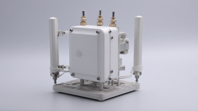
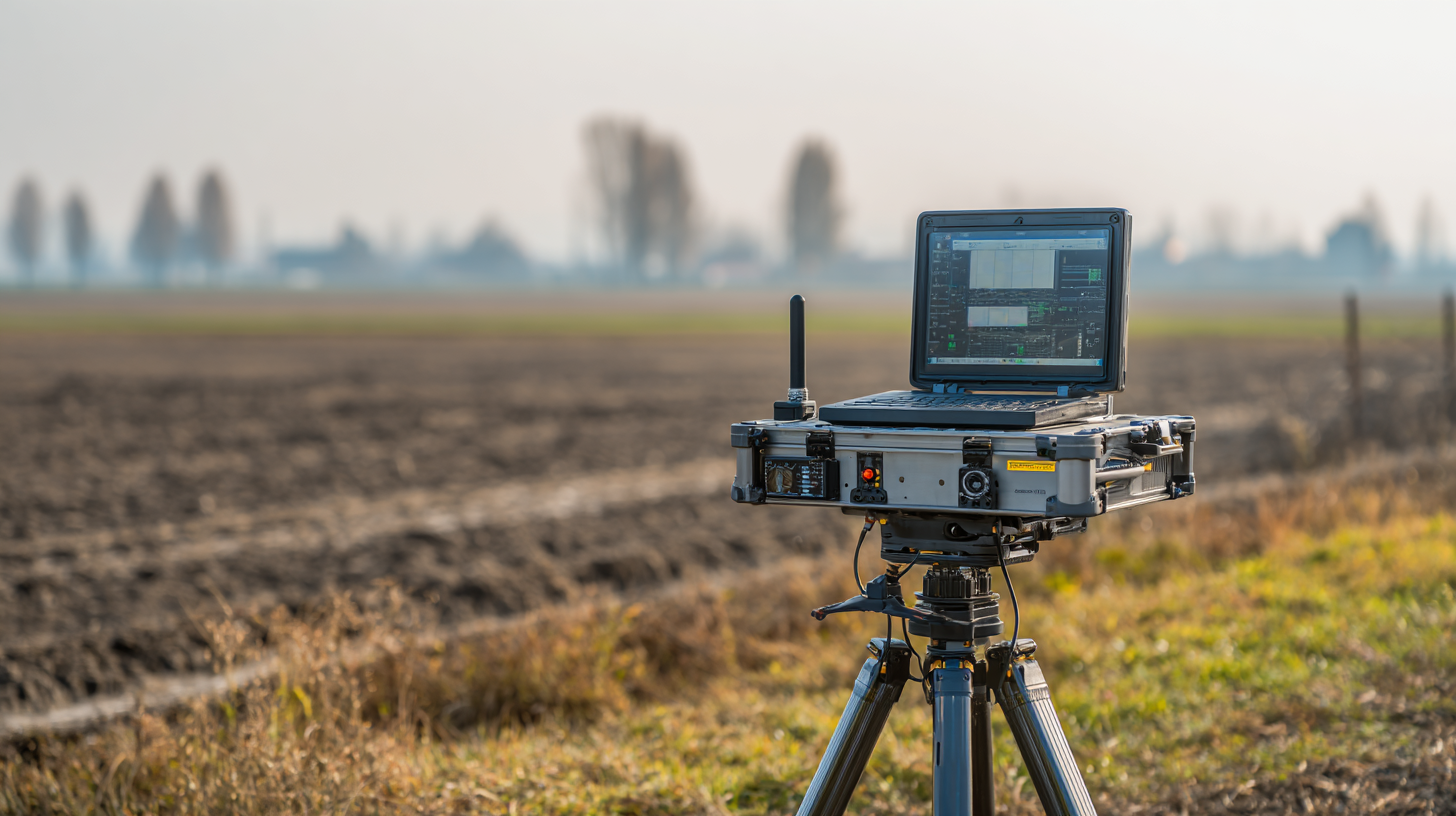
Key Innovations in Base Station Technology for Improved Accuracy
As the need for really precise positioning keeps growing, the technology behind GNSS RTK base stations is more important than ever for boosting overall accuracy. I’ve read some recent reports from the European GNSS Agency, and it’s pretty impressive—they say that the average accuracy of GNSS systems has gotten about 30% better over the past five years. That’s largely thanks to smarter algorithms and improved signal processing. Stuff like multi-frequency and multi-constellation tracking is now pretty much standard practice—it lets base stations tap into signals from different satellite systems, which helps make things more reliable and sturdy, even in tricky environments.
And get this—RTK corrections, which we’ve relied on for pinpoint accuracy, have come a long way. The rollout of networked RTK, or NRTK, now lets base stations swap correction data over large areas. Basically, it means we can get positioning accuracy down to just a few centimeters. The Journal of Navigation mentions that NRTK can hit horizontal precision better than 2 cm and verticals within 5 cm—that’s game-changing compared to standalone RTK setups from before. All these upgrades aren’t just game changers for sectors like farming, construction, and surveying; they’re also super important for autonomous cars and robot systems, making GNSS applications even more dependable.
All in all, it feels like we’re moving into a future where precise positioning is more accurate and reliable than ever, and I think that’s pretty exciting!
Enhancing Rover Systems: How New Algorithms Increase Performance
Lately, there have been some pretty exciting advances in algorithms that are really boosting how well GNSS RTK rover systems perform. I was reading a report from the International GNSS Service (IGS), and it turns out that by incorporating machine learning techniques, these systems have managed to cut down position errors by up to 30%. That’s a game-changer, especially since it makes real-time positioning way more reliable. These new algorithms don’t just get better accuracy—they also respond faster, even in tough environmental conditions. So, users can count on getting precise data, even when things aren’t perfect outside.
One of the coolest parts? These algorithms are 정말 good at handling multi-frequency signals. A study from NOAA mentioned that with some fancy signal processing, rover accuracy in tricky urban canyons can improve by as much as 40%. That’s a huge boost, especially for stuff like farming or construction, where real-time info can make all the difference. Looking ahead, it’s pretty clear that as these techs become more common, GNSS RTK systems are headed for some serious improvements. Honestly, the future seems really bright for these systems—and it’s exciting to see what’s next!
The Role of Multi-Frequency GNSS in Boosting RTK Reliability
You know, the way multi-frequency GNSS (Global Navigation Satellite Systems) is changing the game for RTK (Real-Time Kinematic) systems is honestly pretty impressive. These systems are now way more reliable, whether you're into precision farming or surveying. I remember how, with traditional single-frequency GNSS setups, you'd often hit snags because of signal interference or ionospheric hiccups—making things a lot less accurate. But now, with multi-frequency tech, users can tap into signals from a bunch of different frequencies, which really helps cut down on those errors. According to a recent study by the International GNSS Service (IGS), using multi-frequency GNSS can bump up your positioning accuracy by around 30% on average—that’s a pretty big deal for any high-stakes project.
If you're serious about getting the most out of your RTK setup, it’s worth looking into dual or even triple-frequency receivers. These don’t just give you better accuracy—they also make your signals way more reliable, especially when you're in tricky environments. And don’t forget, keeping an eye on satellite constellations is a smart move—when new satellites come into play, they can bring stronger signals your way. Regularly calibrating your equipment is another simple thing that ensures you're really taking advantage of all these new advancements.
On top of that, having a solid RTK strategy—like monitoring your system in real-time and applying corrective measures—can seriously boost your overall performance. Industry reports have shown that layering multi-frequency GNSS into what you already use can cut downtime and make your workflow up to 20% more efficient. So, just staying informed and proactive can make a huge difference in keeping your GNSS RTK systems running at their best.
Integrating IoT and Cloud Computing for Better RTK Data Management
You know, the way IoT and cloud tech are coming together is really changing how we think about GNSS RTK systems. Basically, with IoT devices, the base and rover units can gather data from sensors and satellites on the fly—making the positioning way more accurate. These devices are all connected over the internet, so data gets sent and processed instantly. That’s a game-changer for things like farming, construction, or even self-driving cars, where precision really matters.
And then there’s cloud computing, which takes it to the next level. Storing all that RTK data in the cloud means you can access and analyze tons of info without being limited by local hardware. Plus, it makes teamwork way easier because everyone can share data smoothly across different devices and locations. The cloud’s advanced analytics tools can crunch all that info to give you helpful insights, making workflows smoother and boosting productivity. All in all, the combo of IoT and cloud tech is opening up a whole new world of smarter, more reliable GNSS RTK solutions.
User-Friendly Interfaces: Simplifying GNSS RTK System Operations
User-friendly interfaces really make a huge difference when it comes to using GNSS RTK systems. They help more folks get the hang of precise positioning technology without all the fuss. I came across this report from MarketsandMarkets that says the worldwide market for GNSS devices is expected to jump from about $209.8 billion in 2020 to around $340.5 billion by 2025. That just shows how much people want these systems to be easier and more accessible, especially as they get more complex. Because of this, manufacturers are focusing more on creating intuitive designs—things that are easier for newbies to learn and also make life easier for experts who’ve been using them forever.
Latest tech like touchscreens and simplified software are really helping to make GNSS RTK systems more user-friendly. A study published in the International Journal of Geographical Information Science even found that designing systems with the user in mind can cut down mistakes by up to 30%. That means better data and more efficient work overall. These improvements are not just helping surveyors or farmers—they’re making these advanced tools more approachable for everyone. Plus, they're in line with the whole industry shift toward automation and smarter integrations, making GNSS tech more inclusive and easier for just about anyone to adopt.
Innovative Solutions for Enhancing GNSS RTK Systems
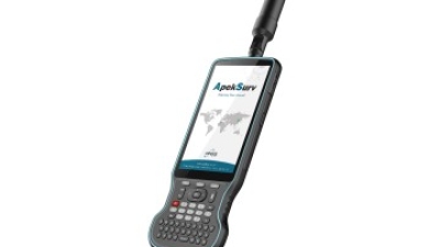
Unleashing Precision: The Role of Apeks Stylus Pens in Android 10-Controlled GNSS RTK Solutions for GIS and Surveying
The integration of advanced technology in Geographic Information Systems (GIS) and surveying has reached new heights with the introduction of high-precision tools like the Apeks Stylus Pen, particularly when paired with Android 10-controlled GNSS RTK solutions. The UM980 motherboard, featuring a robust 2.0 GHz industrial processor, serves as the backbone for these sophisticated applications. This powerful combination enables surveyors to achieve remarkable accuracy while collecting data in the field, critical for projects that rely on precise spatial analysis and mapping.
Moreover, the 9000mAh long-lasting battery and 64GB ROM paired with 4GB DDR4 RAM ensure that professionals can work uninterrupted, even in remote locations where power sources may be scarce. This ergonomically designed device, complemented by the innovative Corti Keyboard, not only enhances user experience but also boosts productivity by reducing input time and improving data accuracy. According to a report by the International Federation of Surveyors (FIG), the demand for mobile computing solutions in surveying is expected to increase by 30% within the next five years, underscoring the importance of integrating tools like the Apeks Stylus Pen into robust Android platforms.
As GIS and surveying landscapes evolve, precision tools that harness the power of Android 10 and RTK technology will become indispensable. The benefits are evident, with industry reports indicating that implementing such advanced systems can reduce survey time by up to 50%. By powering their operations with the latest technology, surveyors can not only enhance accuracy but also significantly boost efficiency, paving the way for faster project completion and improved overall results.
FAQS
: Recent studies indicate a 30% improvement in the average accuracy of GNSS systems due to advanced algorithms and enhanced signal processing techniques, including multi-frequency and multi-constellation tracking.
NRTK allows base stations to share correction data over wide areas, achieving horizontal accuracy of less than 2 cm and vertical accuracy of less than 5 cm, far exceeding standalone RTK systems.
New algorithms, including machine learning techniques, have reduced position error by up to 30%, improving the reliability and response time of real-time kinematic positioning.
Enhanced signal processing methods can improve accuracy within challenging environments, such as urban canyons, by up to 40%, benefiting various applications like agriculture and construction.
User-friendly interfaces simplify operations, enabling more users to effectively utilize precise positioning technology and contributing to the growing demand for accessibility in complex systems.
Innovations include touch-screen controls and streamlined software, which reduce operational errors by up to 30% and enhance overall productivity and data accuracy.
The integration of advanced technologies and user-centric designs is expected to drive further enhancements in GNSS RTK systems, making them more efficient and widely adopted across various industries.
The GNSS device market is projected to grow from USD 209.8 billion in 2020 to USD 340.5 billion by 2025, indicating increasing demand for more accessible and user-friendly technologies.
Improved GNSS RTK accuracy benefits sectors such as agriculture, construction, surveying, autonomous vehicles, and robotic systems, enhancing their operational efficiency and reliability.
Intuitive design minimizes the learning curve for new users while enhancing operational efficiency for experienced professionals, catering to a diverse user base and promoting broader adoption of advanced GNSS technologies.
Conclusion
In the fast-changing world of geospatial surveying, improving GNSS RTK base and rover systems is pretty much a must if you want better accuracy and reliability. In this blog, I want to walk you through some of the latest innovations—especially focusing on how advanced signal processing techniques can really boost data precision. We’ll also look at how new tech in base stations helps improve performance, making your data more reliable in GNSS RTK setups. Plus, I’ll highlight some fresh algorithms for rover systems that really help take things to the next level.
Another exciting development is the use of multi-frequency GNSS technology, which makes RTK even more dependable. And with IoT and cloud computing, managing all that data gets a whole lot easier. Of course, user-friendly interfaces are key—they make operating these systems a lot simpler, so more people can get on board without all the headaches. Thanks to these advancements, companies like Shanghai Apekstool (APEKS) are in a great position to offer top-notch geospatial solutions that meet today’s surveying needs. It’s an exciting time, for sure!